Bures Dispersal Area Map
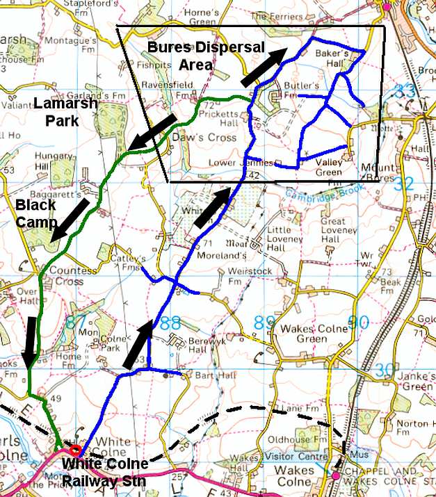 |
This map shows the extent of the Bures
dispersal site. However,the site actually extended all the way to
White Colne and out to Countess Cross.
Although not actually documented
the USAAF did appear to use a one way system as indicated by the
arrows on the above map. It would have been impossible for the large
transporters to pass each other on these narrow winding country
roads. The return journey would have taken the vehicles back to
the main road for their onward journey to the Essex airfields.
Along the road towards Countess Cross, negro USAAF personnel were
used for the road building, billeted under canvas. To this day the
area is still known as Blacks Camp.
Inside Lamarsh Park (Panhandle Wood) the USAAF had four huts which
were used for the storage of ammunition. Foundations to these buildings
can still be seen today.
The White Colne Dispersal area was
restricted to the main road (in red)between White Colne and Lower
Jennies Farm. Northwards from this point was the main dispersal.
There is no evidence of side roads being used.
BURES
DISPERSAL SITE
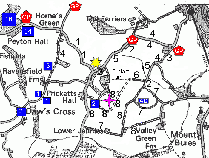
Information taken from original
USAAF Architect drawings
|
The single number
insert shows how many individual bomb dumps were at each site.
There may have been as many as 50 -100 bombs at each store
Bomb dumps were usually 125 yards apart for obvious safety reasons.
They were also placed at a minimum of 250 yards from any residential
property.
The total number of open bomb dumps in the area, covered by the
map exceeds 70. |
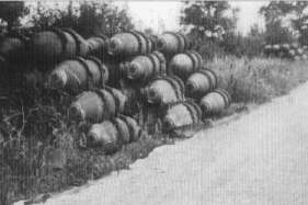 Bomb Dumps along the Colne
Road.
Bomb Dumps along the Colne
Road. |
Admin Block
(AD)- this housed office
and canteen facilities
Incendiary
Bomb Store - this was located under cover of a wood at
Butlers Farm
Huts
- Clees Hall Wood contained something like 16 huts with
it`s own road network. Only the foundations now remain and the roads
degraded to overgrown tracks.
The huts were used as accommodation for the Air Force personnel. They
were secure from enemy aircraft hidden by the tree camouflage.
This wood is private property.
The searchlight along
the Earls Colne Road was remote from the anti-aircraft gun, which
was located at Fordham Heath.
It was not unusual to see the light following an enemy aircraft, while
tracer shells lit up the night sky coming up from Fordham.
Text
courtesy of Eric Doe, Trevor Riches, Carl Imrie & Mr & Mrs
Scanlan